76 nights onboard Borealis

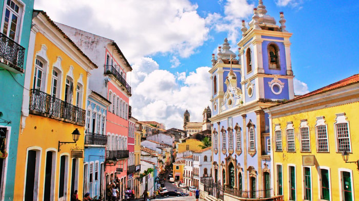
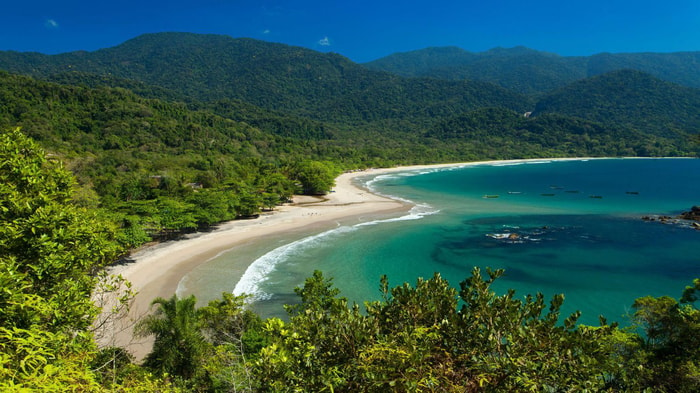
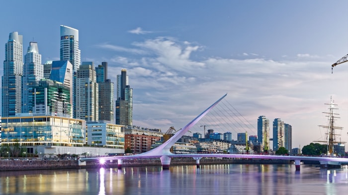
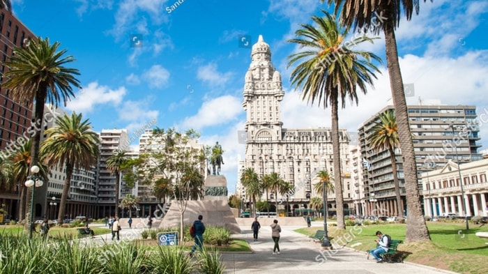
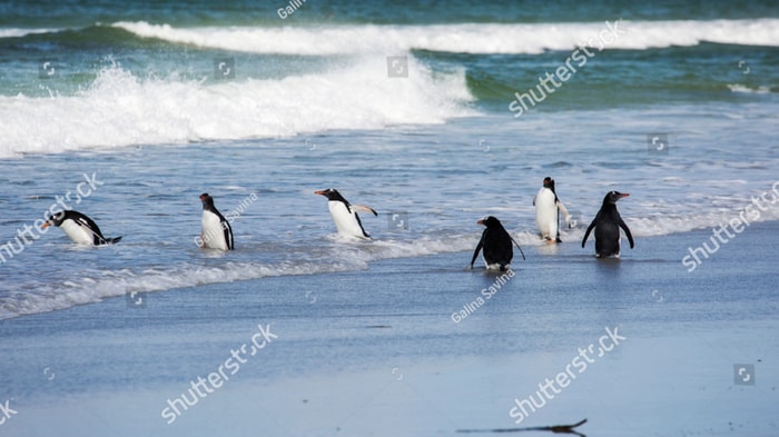
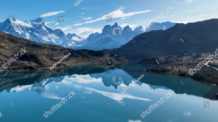
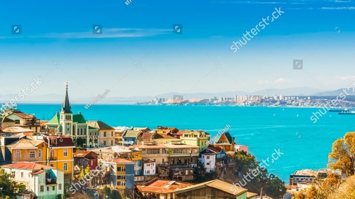
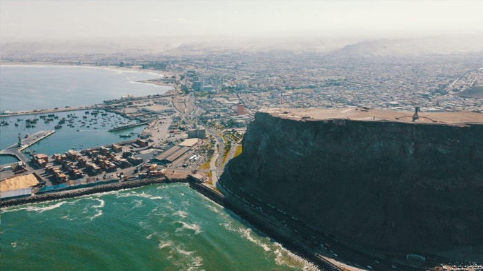
Exploration of South America and the Antarctic

Winners 2022 Favourite Ocean Cruise Line

Thanks to her ability to cruise at higher speeds than other ships, Borealis – sister ship of our flagship Bolette – is perfectly suited for sailing our longer voyages across the globe. Cruising faster means she can include more stops, scenic discoveries and highlights into each itinerary.

Leaving from: Southampton
Cruise ship: Borealis
Visiting: Southampton La Coruña Las Palmas de Gran Canaria Praia, Santiago Island
Fred. Olsen Cruise Lines Logo
Fred. Olsen Cruise Lines

Fred Olsen Cruises combine quality cruise experiences with customer-friendly value. They’ve plied the waves for 175 years, and are still going as strong today as their first day at sea.

Offering a stylish & understated style of traditional cruising, the line prides itself on its Signature Experience programme- helping passengers to gain an in-depth understanding of their destinations.

Ideal for passengers seeking a laid-back cruise, with an informal and friendly atmosphere aboard.

1360
Passengers
662
Crew
1997
Launched
2015
Last refit
61849t
Tonnage
238m
Length
34m
Width
22kts
Speed
10
Decks
GBP
Currency
Cruise Itinerary
Day 1
Southampton, England
Departure time: Late PM
Day 3
La Coruña, Spain
Arrival time: Early PM; Departure time: Late PM
Day 6
Las Palmas de Gran Canaria, Spain
Arrival time: Early AM; Departure time: Late PM
Day 9
Praia, Santiago Island, Cape Verde
Arrival time: Early AM; Departure time: Late PM
Day 15
Salvador de Bahia, Brazil
Arrival time: Early AM; Departure time: Late PM
Days 17 - 18
Rio de Janeiro, Brazil
Arrival time: Late PM; Departure time: Late PM
Day 20
Ilhabela, Brazil
Arrival time: Early AM; Departure time: Late PM
Days 23 - 24
Buenos Aires, Argentina
Arrival time: Early AM; Departure time: Late PM
Day 25
Montevideo, Uruguay
Arrival time: Early AM; Departure time: Late PM
Day 28
Port Stanley, Falkland Islands (Malvinas)
Arrival time: Early AM; Departure time: Late PM
Days 31 - 32
River travel
Arrival time: Early AM; Departure time: Late PM
Day 36
Punta Arenas, Chile
Arrival time: Early AM; Departure time: Late PM
Days 37 - 38
River travel
Arrival time: Early AM; Departure time: Late PM
Day 42
Valparaiso, Chile
Arrival time: Early AM; Departure time: Late PM
Day 43
Coquimbo, Chile
Arrival time: Early AM; Departure time: Late PM
Day 45
Iquique, Chile
Arrival time: Early AM; Departure time: Late Night
Day 46
Arica, Chile
Arrival time: Early AM; Departure time: Late PM
Day 48
Paracas, Peru
Arrival time: Early AM; Departure time: Late Night
Days 49 - 50
Callao, Peru
Arrival time: Early AM; Departure time: Late Night
Day 53
Guayaquil, Ecuador
Arrival time: Early AM; Departure time: Late Night
Day 56
River travel
Arrival time: Early AM; Departure time: Late PM
Day 57
Puerto Limón, Costa Rica
Arrival time: Early AM; Departure time: Late PM
Day 58
Colón, Panama
Arrival time: Early AM; Departure time: Late PM
Days 59 - 60
Cartagena, Colombia
Arrival time: Early PM; Departure time: Late PM
Day 62
Willemstad, Curaçao
Arrival time: Early AM; Departure time: Late PM
Day 64
Port Elizabeth, Bequia, Saint Vincent and the Grenadines
Arrival time: Early AM; Departure time: Late PM
Day 65
Saint John's, Antigua and Barbuda
Arrival time: Late AM; Departure time: Late Night
Day 66
Philipsburg, Sint Maarten (Dutch part)
Arrival time: Early AM; Departure time: Late PM
Day 73
Ponta Delgada, Azores, Portugal
Arrival time: Early AM; Departure time: Late PM
Day 77
Southampton, England
Arrival time: Early AM
Southampton, England image
Day 1
Southampton, England

Lying near the head of Southampton Water, a peninsula between the estuaries of the Rivers Test and Itchen, Southampton is Britain’s largest cruise port. It has been one of England’s major ports since the Middle Ages, when it exported wool and hides from the hinterland and imported wine from Bordeaux. The city suffered heavy damage during World War Two and as a result the centre has been extensively rebuilt, but there are still some interesting medieval buildings including the Bargate, one of the finest city gatehouses in England.

La Coruña, Spain image
Day 3
La Coruña, Spain

Situated on the northwestern tip of the Iberian Peninsula, the city of La Coruña (or A Coruña, its official name) is the closest European port to New York. And perhaps in keeping with its location, the coastal city itself is charming blend of old and new, filled with culture, splendid architecture and fascinating museums, along with pristine beaches and open spaces. La Coruña is also the gateway to Galicia, one of the most verdant and scenic regions in Spain.

Las Palmas de Gran Canaria, Spain image
Day 6
Las Palmas de Gran Canaria, Spain
Perhaps the prettiest of the Canary Islands, Gran Canaria is an almost circular isle with the peak of Pozo de Las Nieves, its highest point, at the centre. With a wealth of natural beauty and all the exciting attractions of city life in the capital, the island offers the best of both worlds. You will no doubt wish to see the sights of the capital’s old quarter, which dates back to the 15th century and encompassses the Vegueta and Triana districts, and wherever you go you can enjoy the glorious subtropical climate, perfect for growing exotic palms and fruits.
Praia, Santiago Island, Cape Verde image
Day 9
Praia, Santiago Island, Cape Verde
Start your Expedition Cruise in Praia, the capital of Cape Verde, located in the south of Santiago Island. You can explore its old centre overlooking the ocean and its historical buildings with transom windows. In the old quarter, you can also learn about the diversity of the archipelago’s cultural origins in the Ethnographic Museum. To finish your day, head to the harbour to visit the Diogo Gomes statue, paying homage to the man who discovered the archipelago in 1460.
Salvador de Bahia, Brazil image
Day 15
Salvador de Bahia, Brazil
According to Salvador's adopted son Jorge Amado, "In Salvador, magic becomes part of the every-day." From the shimmering golden light of sunset over the Baía do Todos os Santos, to the rhythmic beats that race along the streets, Salvador, while no longer Brazil's capital, remains one of its most captivating cities. A large dose of its exoticism comes down to its African heritage—at least 70% of its 2,675,000 population is classified as Afro-Brazilian—and how it has blended into Brazil's different strands, from the native Indians to the Christian colonizers. Salvadorans may tell you that you can visit a different church every day of the year, which is almost true—the city has about 300. Churches whose interiors are covered with gold leaf were financed by the riches of the Portuguese colonial era, when slaves masked their traditional religious beliefs under a thin Catholic veneer. And partly thanks to modern-day acceptance of those beliefs, Salvador has become the fount of Candomblé, a religion based on personal dialogue with the orixás, a family of African deities closely linked to nature and the Catholic saints. The influence of Salvador's African heritage on Brazilian music has also turned the city into one of the musical capitals of Brazil, resulting in a myriad of venues to enjoy live music across the city, along with international acclaim for exponents like Gilberto Gil, Caetano Veloso, and Daniela Mercury. Salvador's economy today is focused on telecommunications and tourism. The still-prevalent African culture draws many tourists—this is the best place in Brazil to hear African music, learn or watch African dance, and see capoeira, a martial art developed by slaves. In the district of Pelourinho, many colorful 18th- and 19th-century houses remain, part of the reason why this is the center of the tourist trade. Salvador sprawls across a peninsula surrounded by the Baía de Todos os Santos on one side and the Atlantic Ocean on the other. The city has about 50 km (31 miles) of coastline. The original city, referred to as the Centro Histórica (Historical Center), is divided into the Cidade Alta (Upper City), also called Pelourinho, and Cidade Baixa (Lower City). The Cidade Baixa is a commercial area—known as Comércio—that runs along the port and is the site of Salvador's indoor market, Mercado Modelo. You can move between the upper and lower cities on foot, via the landmark Elevador Lacerda, behind the market, or on the Plano Inclinado, a funicular lift, which connects Rua Guindaste dos Padres on Comércio with the alley behind Cathedral Basílica. From the Cidade Histórica you can travel north along the bay to the hilltop Igreja de Nosso Senhor do Bonfim. You can also head south to the point, guarded by the Forte Santo Antônio da Barra, where the bay waters meet those of the Atlantic. This area on Salvador's southern tip is home to the trendy neighborhoods of Barra, Ondina, and Rio Vermelho, with many museums, theaters, shops, and restaurants. Beaches along the Atlantic coast and north of Forte Santo Antônio da Barra are among the city's cleanest. Many are illuminated at night and have bars and restaurants that stay open late.
Rio de Janeiro, Brazil image
Days 17 - 18
Rio de Janeiro, Brazil
Welcome to the Cidade Maravilhosa, or the Marvelous City, as Rio is known in Brazil. Synonymous with the girl from Ipanema, the dramatic views from Christ the Redeemer atop Corcovado mountain, and fabulously flamboyant Carnival celebrations, Rio is a city of stunning architecture, abundant museums, and marvelous food. Rio is also home to 23 beaches, an almost continuous 73-km (45-mile) ribbon of sand.As you leave the airport and head to Rio's beautiful Zona Sul (the touristic South Zone), you'll drive for about 40 minutes on a highway from where you'll begin to get a sense of the dramatic contrast between beautiful landscape and devastating poverty. In this teeming metropolis of 12 million people (6.2 million of whom live in Rio proper), the very rich and the very poor live in uneasy proximity. You'll drive past seemingly endless cinder-block favela, but by the time you reach Copacabana's breezy, sunny Avenida Atlântica—flanked on one side by white beach and azure sea and on the other by condominiums and hotels—your heart will leap with expectation as you begin to recognize the postcard-famous sights. Now you're truly in Rio, where cariocas (Rio residents) and tourists live life to its fullest.Enthusiasm is contagious in Rio. Prepare to have your senses engaged and your inhibitions untied. Rio seduces with a host of images: the joyous bustle of vendors at Sunday's Feira Hippie (Hippie Fair); the tipsy babble at sidewalk cafés as patrons sip their last glass of icy beer under the stars; the blanket of lights beneath the Pão de Açúcar (Sugarloaf Mountain); the bikers, joggers, strollers, and power walkers who parade along the beach each morning. Borrow the carioca spirit for your stay; you may find yourself reluctant to give it back.
Ilhabela, Brazil image
Day 20
Ilhabela, Brazil
Arrival time: Early AM; Departure time: Late PM
Buenos Aires, Argentina image
Days 23 - 24
Buenos Aires, Argentina
Glamorous and gritty, Buenos Aires is two cities in one. What makes Argentina's capital so fascinating is its dual heritage—part European, part Latin American. Plaza de Mayo resembles a grand square in Madrid, and the ornate Teatro Colón would not be out of place in Vienna. But you’ll know you’re in South America by the leather shoes for sale on cobbled streets and impromptu parades of triumphant soccer fans. Limited-production wines, juicy steaks, and ice cream in countless flavors are among the old-world imports the city has perfected.
Montevideo, Uruguay image
Day 25
Montevideo, Uruguay
Uruguay’s capital city hugs the eastern bank of the Río de la Plata. A massive coastal promenade (malecón) that passes fine beaches, restaurants, and numerous parks recalls the sunny sophistications of the Mediterranean and is always dotted with Montevideans strolling, exercising, and lounging along the water. Montevideo has its share of glitzy shopping avenues and modern office buildings, balanced with its historic old city and sumptuous colonial architecture, as well as numerous leafy plazas and parks. It is hard not to draw comparisons to its sister city Buenos Aires across the river, and indeed Montevideo strikes many as a calmer, more manageable incarnation of Argentina's capital.When the weather's good, La Rambla, a 22-km (14-mile) waterfront avenue that links the Old City with the eastern suburbs and changes names about a dozen times, gets packed with fishermen, ice-cream vendors, and joggers. Around sunset, volleyball and soccer games wind down as couples begin to appear for evening strolls. Polls consistently rate Montevideo as having the highest quality of life of any city in Latin America. After one visit here, especially on a lovely summer evening, you probably will agree.
Port Stanley, Falkland Islands (Malvinas) image
Day 28
Port Stanley, Falkland Islands (Malvinas)
Tiny Stanley, capital of the Falklands, seems in many ways like a British village fallen out of the sky. Many homes are painted in bright colours, adding visual appeal to this distant outpost. Not far offshore, the wreck of the Lady Elizabeth, is one of the many vessels remaining as a silent testimonial to the region's frequent harsh weather conditions.The islands, also known by their Spanish name of Islas Malvinas, are home to arguably more tuxedo-clad inhabitants of the penguin variety than human residents. Various species, such as Gentoo, Magellanic and the more elusive King penguins, either live here permanently or use the Falklands as a stopover on their migration route. Darwin found the islands' flora and fauna fascinating - no doubt you will, too.
River travel image
Days 31 - 32
River travel
Arrival time: Early AM; Departure time: Late PM
Punta Arenas, Chile image
Day 36
Punta Arenas, Chile
Impenetrable forests, impassable mountains, and endless fields of ice define Chilean Patagonia, and meant that the region went largely unexplored until the beginning of the 20th century. Located in the southernmost part of the country, this area is still sparsely inhabited, though you will find a few populated places—like the colorful provincial city of Punta Arenas, which looks like it's about to be swept into the Strait of Magellan. Some unique wildlife, particularly colonies of elephant seals and penguins, call this breathtaking topography home. To the north is Parque Nacional Torres del Paine, the country's most magnificent natural wonder, and whose snow-covered peaks seem to rise vertically from the plains below. The vistas, such as the fantastic Avenue of the Glaciers, are breathtaking; along this stretch of the Beagle Channel, you can pass six tremendous glaciers all within a stone's throw of each other.Cruise SightsPunta Arenas. Founded a little more than 150 years ago, Punta Arenas (Sandy Point) was Chile's first permanent settlement in Patagonia. Plaza Muñoz Gamero, the central square, is surrounded by evidence of that early prosperity: buildings whose then-opulent brick exteriors recall a time when this was one of Chile's wealthiest cities. The newer houses here have colorful tin roofs, best appreciated when seen from a high vantage point such as the Mirador Cerro la Cruz. Although the city as a whole may not be particularly attractive, look for details: the pink-and-white house on a corner, the bay window full of potted plants, parking attendants wearing the regional blue and yellow colors, and schoolchildren in identical naval pea coats that remind you that the city's fate is tied to the sea.The Museo Naval y Marítimo extols Chile's high-seas prowess, particularly concerning Antarctica. Its exhibits are worth a visit for anyone with an interest in ships and sailing, merchant and military alike. Part of the second floor is designed like the interior of a ship, including a map and radio room. Pedro Montt 989. Admission charged.Housed in what was once the mansion of the powerful Braun-Menéndez family, the Museo Regional de Magallanes is an intriguing glimpse into the daily life of a wealthy provincial family at the beginning of the 20th century. Lavish Carrara marble hearths, English bath fixtures, and cordovan leather walls are among the original accoutrements. The museum also has an excellent group of displays depicting Punta Arenas's past, from the first European contact to the town's decline after the opening of the Panama Canal. The museum is half a block north of the main square. Magallanes 949. Admission charged.The resplendent 1895 Palacio Sara Braun is a national landmark and an architectural showpiece of southern Patagonia. Designed by a French architect, the house was built from materials and by craftsmen imported from Europe during the four years of construction. The city's central plaza and surrounding buildings soon followed, ushering in the region's golden era. Noteworthy are the lavish bedrooms, magnificent parquet floors, marble fireplaces, and hand-painted ceilings. Don't miss the portraits of Braun and her husband José Nogueira in the music room. Afterwards, head to the cellar for a drink or snack in the warm public tavern (a good portion of the mansion is leased to a hotel). Plaza Muñoz Gamero 716. Admission charged.Commonly referred to simply as "El Salesiano," the Museo Salesiano de Maggiorino Borgatello is operated by Italian missionaries whose order arrived in Punta Arenas in the 19th century. The Salesians, most of whom spoke no Spanish, proved to be daring explorers. Traveling throughout the region, they collected the artifacts made by indigenous tribes that are currently on display. Av. Bulnes 398. Admission charged.Isla Magdalena. Punta Arenas is the launching point for a boat trip to the Isla Magdalena to see the more than 100,000 Magellanic penguins at the Monumento Natural Los Pingúinos. A single trail, marked off by rope, is accessible to humans. The boat trip to the island, in the middle of the Estrecho de Magallanes, takes about two hours. Make sure to bring along warm clothing, even in summer; the island can be chilly, particularly if a breeze is blowing across the water.Parque Nacional Torres del Paine. Some 12 million years ago, lava flows pushed up through the thick sedimentary crust that covered the southwestern coast of South America, cooling to form a granite mass. Glaciers then swept through the region, grinding away all but the ash-gray spires that rise over the landscape of one of the world's most beautiful natural phenomena, now the Parque Nacional Torres del Paine (established in 1959). Snow formations dazzle along every turn of road, and the sunset views are spectacular.Among the 2,420-square-km (934-square-mi) park's most beautiful attractions are its lakes of turquoise, aquamarine, and emerald green waters. Another draw is its unusual wildlife. Creatures like the guanaco (a woollier version of the llama) and the ñandú (resembling a small ostrich) abound. They are used to visitors and don't seem to be bothered by the proximity of automobile traffic and the snapping of cameras. Predators, like the gray fox, make less frequent appearances. You may also spot the dramatic aerobatics of a falcon and the graceful soaring of the endangered condor. The beautiful puma is especially elusive, but sightings have become more common. Admission charged.Pingúinera de Seno Otway. The road to this penguin sanctuary begins 30 km (18 mi) north of Punta Arenas. Magellanic penguins, which live up to 20 years in the wild, return to their birthplace here every year to mate with the same partner. For about 2,000 penguin couples—no single penguins make the trip—home is this desolate and windswept land off the Otway Sound. In late September, the penguins begin to arrive from the southern coast of Brazil and the Falkland Islands. They mate and lay their eggs in early October, and brood their eggs in November. Offspring hatch between mid-November and early December. If you're lucky, you may catch sight of one of the downy gray chicks that stick their heads out of the burrows when their parents return to feed them. Otherwise you might see scores of the ungainly adult penguins waddling to the ocean from their nesting burrows. They swim for food every eight hours and dive up to 100 feet deep. The penguins depart from the sound in late March. Note that the sanctuary is a 1-km (1/2-mi) walk from the parking lot. It gets chilly, so bring a windbreaker. Admission charged.Reserva Nacional Laguna Parillar. This 47,000-acre reserve lies west of Puerto Hambre, a tranquil fishing village, and is centered around a shimmering lake in a valley flanked by hills. It's a great place for a picnic, and there are a number of well-marked paths that offer sweeping vistas over the Estrecho de Magallanes. About 2 km (1 mi) west of Puerto Hambre is a small white monolith that marks the geographical center of Chile, the midway point between Chile's northern port Arica and the South Pole.Cruise ShoppingWool may no longer be king of the economy, but vast flocks of sheep still yield a high-quality product that is woven into the clothing here. Leather products are also common, but the prices are not necessarily low. About 3 km (2 mi) north of Punta Arenas is the Zona Franca (Av. Bulnes). This duty-free zone is where people from all around the region come for low-priced electronics and other consumer items.
River travel image
Days 37 - 38
River travel
Arrival time: Early AM; Departure time: Late PM
Valparaiso, Chile image
Day 42
Valparaiso, Chile
Valparaíso's dramatic topography—45 cerros, or hills, overlooking the ocean—requires the use of winding pathways and wooden ascensores (funiculars) to get up many of the grades. The slopes are covered by candy-color houses—there are almost no apartments in the city—most of which have exteriors of corrugated metal peeled from shipping containers decades ago. Valparaíso has served as Santiago's port for centuries. Before the Panama Canal opened, Valparaíso was the busiest port in South America. Harsh realities—changing trade routes, industrial decline—have diminished its importance, but it remains Chile's principal port. Most shops, banks, restaurants, bars, and other businesses cluster along the handful of streets called El Plan (the flat area) that are closest to the shoreline. Porteños (which means "the residents of the port") live in the surrounding hills in an undulating array of colorful abodes. At the top of any of the dozens of stairways, the paseos (promenades) have spectacular views; many are named after prominent Yugoslavian, Basque, and German immigrants. Neighborhoods are named for the hills they cover. With the jumble of power lines overhead and the hundreds of buses that slow down—but never completely stop—to pick up agile riders, it's hard to forget you're in a city. Still, walking is the best way to experience Valparaíso. Be careful where you step, though—locals aren't very conscientious about curbing their dogs.
Coquimbo, Chile image
Day 43
Coquimbo, Chile
The name Coquimbo is derived from a native Diaguita word meaning 'place of calm waters'. In fact, Charles Darwin had noted that the town was 'remarkable for nothing but its extreme quietness'. Since then, Coquimbo has developed into a bustling port and the region's major commercial and industrial centre from which minerals, fish products and fruits are exported. Used during the colonial period as a port for La Serena, Coquimbo attracted attention from English pirates, including Sir Francis Drake, who visited in 1578. Visitors enjoy strolling around the town, admiring some of the elaborate woodwork handcrafted on buildings by early British and American settlers. These wooden buildings are among Chile's most interesting historical structures. Out of town, the area offers some fine beaches in a desert-like setting. Coquimbo serves as a gateway to the popular resort town of La Serena and trips farther into the Elqui Valley, known as the production centre for Chile's national drink, pisco sour. The valley is also home to several international observatories that take advantage of the region's exceptional atmospheric conditions.
Iquique, Chile image
Day 45
Iquique, Chile
Arrival time: Early AM; Departure time: Late Night
Arica, Chile image
Day 46
Arica, Chile
Arica boasts that it is "the land of the eternal spring," but its temperate climate and beaches are not the only reason to visit this small city. Relax for an hour or two on the Plaza 21 de Mayo. Walk to the pier and watch the pelicans and sea lions trail the fishing boats as the afternoon's catch comes in. Walk to the top of the Morro and imagine battles of days gone by, or wonder at the magnitude of modern shipping as Chilean goods leave the port below by container ship.Arica is gaining notice for its great surfing conditions, and in 2009 hosted the Rusty Arica Pro Surf Challenge, a qualifying event to the world series of surf.
Paracas, Peru image
Day 48
Paracas, Peru
The port city of Paracas is blessed with magnificent natural beauty and rich historical importance, offerings inviting beaches, ideal weather and pleasant scenery — a combination that draws visitors throughout the year. The shores of the Paracas Peninsula and waters of the bay teem with wildlife and have been declared a national reserve. Condors frequently can be seen gliding on the sea winds or perched on the cliffs; pink flamingos often rest here on their migratory flights. The complex interaction between wind and ocean, sun and land has transformed this region into a kind of lunarscape under an equatorial sun. Another reason for travellers to come to this area is its proximity to the famous and mysterious Nazca Lines. Visible from the air, these strange markings stretch for miles on a large barren plain and have bewildered archaeologists, historians and mathematicians since their discovery over a century ago. The earliest Andean people found shelter here. The Paracas culture was known for fine weavings in geometrical designs and vibrant colours, which have been preserved for thousands of years by the dry climate. Some of the finest examples are in museums in Lima. The town of Ica is Peru’s finest wine centre, as well as home to the fiery brandy-derived beverage known as Pisco. The surrounding area features oases with springs considered to have medicinal cures. Pier Information The ship is scheduled to dock at Port of Paracas, about a 45-minute drive from Ica. There are no passenger facilities at the pier. Shopping Shopping opportunities are limited; some souvenirs can be found at the museum in Ica. A bottle of Peruvian Pisco (grape brandy) makes a nice memento. The local currency is the nuevo sol. Cuisine Seafood is highly recommended, however, we recommend you dine only in the hotel restaurants in Peru’s southern region. Be sure to sample the national drink pisco sour and the area’s excellent wines. Always drink bottled water and avoid ice cubes. Other Sites The Bay of Paracas is sheltered by the Paracas peninsula, noted as one of the best marine reserves in the world. This is also a popular resort area thanks to its beautiful bay, beaches and dependable warm weather. Facilities include swimming pools, tennis courts, miniature golf and a good restaurant. For those who are looking for a little adventure dune buggies are available. Local boat trips can be booked to the Ballestas Islands but be aware that commentary is given in Spanish. Private arrangements for independent sightseeing are limited in this port as cars have to come from Lima. Please submit your request to the Tour Office early in the cruise.
Callao, Peru image
Days 49 - 50
Callao, Peru
When people discuss great South American cities, Lima is often overlooked. But Peru's capital can hold its own against its neighbors. It has an oceanfront setting, colonial-era splendor, sophisticated dining, and nonstop nightlife.It's true that the city—clogged with traffic and choked with fumes—doesn't make a good first impression, especially since the airport is in an industrial neighborhood. But wander around the regal edifices surrounding the Plaza de Armas, among the gnarled olive trees of San Isidro's Parque El Olivar, or along the winding lanes in the coastal community of Barranco, and you'll find yourself charmed.In 1535 Francisco Pizarro found the perfect place for the capital of Spain's colonial empire. On a natural port, the so-called Ciudad de los Reyes (City of Kings) allowed Spain to ship home all the gold the conquistador plundered from the Inca. Lima served as the capital of Spain's South American empire for 300 years, and it's safe to say that no other colonial city enjoyed such power and prestige during this period.When Peru declared its independence from Spain in 1821, the declaration was read in the square that Pizarro had so carefully designed. Many of the colonial-era buildings around the Plaza de Armas are standing today. Walk a few blocks in any direction for churches and elegant houses that reveal just how wealthy this city once was. But the poor state of most buildings attests to the fact that the country's wealthy families have moved to neighborhoods to the south over the past century.The walls that surrounded the city were demolished in 1870, making way for unprecedented growth. A former hacienda became the graceful residential neighborhood of San Isidro. In the early 1920s the construction of tree-lined Avenida Arequipa heralded the development of neighborhoods such as bustling Miraflores and bohemian Barranco.Almost a third of the country's population of 29 million lives in the metropolitan area, many of them in relatively poor conos: newer neighborhoods on the outskirts of the city. Most residents of those neighborhoods moved there from mountain villages during the political violence and poverty that marked the 1980s and ’90s, when crime increased dramatically. During the past decade the country has enjoyed peace and steady economic growth, which have been accompanied by many improvements and refurbishment in the city. Residents who used to steer clear of the historic center now stroll along its streets. And many travelers who once would have avoided the city altogether now plan to spend a day here and end up staying two or three.
Guayaquil, Ecuador image
Day 53
Guayaquil, Ecuador
The second major jumping off point for the Galapagos Islands after Quito, this is a little city with a big heart. A sea port first and foremost, the city’s personality has been founded on that, and all the better it is for it too. Almost Caribbean in feeling, the clement climate coupled with the intermingling rhythms floating from the windows and abundance of fresh seafood make this a very tropical destination. Once not even considered by the travel books as a potential destination in its own right, the city has undergone something of a resurgence in the past few years. Proud Guayaquileños will not hestitate to point out the Malecón or the exciting new riverfront promenade, once a no-go area after dark, now happily (and hippily) lined with museums, restaurants, shops, and ongoing entertainment. The new airport and urban transportation network are also lauded to the happy tourists who find themselves here. As the largest and most populous city in Ecuador as well as being the commercial centre, it would only be natural that the city would have some kind of modern architecture, but it is the colourful favelas, or to use their real name guasmos, that cling to the side of the hillside like limpets that really catch your eye. A blend of old and new, the first inhabitants can be traced back to 1948 when the government cleared the area for affordable housing, these shanty towns are witness to the social and political particularities that Guayaquil has faced in the past.
River travel image
Day 56
River travel
Arrival time: Early AM; Departure time: Late PM
Puerto Limón, Costa Rica image
Day 57
Puerto Limón, Costa Rica
Christopher Columbus became Costa Rica's first tourist when he landed on this stretch of coast in 1502 during his fourth and final voyage to the New World. Expecting to find vast mineral wealth, he named the region Costa Rica ("rich coast"). Imagine the Spaniards' surprise eventually to find there was none. Save for a brief skirmish some six decades ago, the country did prove itself rich in a long tradition of peace and democracy. No other country in Latin America can make that claim. Costa Rica is also abundantly rich in natural beauty, managing to pack beaches, volcanoes, rain forests, and diverse animal life into an area the size of Vermont and New Hampshire combined. It has successfully parlayed those qualities into its role as one the world's great ecotourism destinations. A day visit is short, but time enough for a quick sample.
Colón, Panama image
Day 58
Colón, Panama
The provincial capital of Colón, beside the canal's Atlantic entrance, is named for the Spanish-language surname of Christopher Columbus, though the Americans called it Aspinwall in the 19th century.. The city was founded in 1850 by Americans working on the Panama railroad and named Aspinwall for one of the railway engineers. Following completion in 1855, Colon gained in importance, which was furthered by the plans for an isthmian canal. During the time of the French canal attempt, a fire in 1885 burned the city nearly to the ground and left thousands of people homeless. Colon was rebuilt in the architectural style then popular in France. Buildings from that era plus the ones constructed by Americans between 1904 and 1914 are still in use today, although the majority is on the verge of collapse. In addition to its importance as a port, Colon boasts the world’s second largest duty-free zone, known as Zona Libre, which is contained in a huge fortress like, walled-off area with giant international stores. However, most of the merchandise is sold in bulk to commercial businesses throughout the country.
Cartagena, Colombia image
Days 59 - 60
Cartagena, Colombia
Cartagena's magnificent city walls and fortresses, now a UNESCO World Heritage Site, enclose a well-restored historic center (the Cuidad Amurallada, or walled city) with plazas, churches, museums, and shops that have made it a lively coastal vacation spot for South Americans and others. New hotels and restaurants make the walled city a desirable place to stay, and the formerly down-at-the-heels Getsemaní neighborhood attracts those seeking a bohemian buzz. The historic center is a small section of Cartagena; many hotels are in the Bocagrande district, an elongated peninsula where high-rise hotels overlook a long, gray-sand beach.When it was founded in 1533 by Spanish conquistador Pedro de Heredia, Cartagena was the only port on the South American mainland. Gold and silver looted from indigenous peoples passed through here en route to Spain and attracted pirates, including Sir Francis Drake, who in 1586 torched 200 buildings. Cartagena's walls protected the city's riches as well as the New World's most important African slave market.
Willemstad, Curaçao image
Day 62
Willemstad, Curaçao
Dutch settlers came here in the 1630s, about the same time they sailed through the Verazzano Narrows to Manhattan, bringing with them original red-tile roofs, first used on the trade ships as ballast and later incorporated into the architecture of Willemstad. Much of the original colonial structures remain, but this historic city is constantly reinventing itself and the government monument foundation is always busy restoring buildings in one urban neighborhood or another. The salty air causes what is called "wall cancer" which causes the ancient abodes to continually crumble over time. The city is cut in two by Santa Anna Bay. On one side is Punda (the point)—crammed with shops, restaurants, monuments, and markets and a new museum retracing its colorful history. And on the other side is Otrobanda (literally meaning the "other side"), with lots of narrow, winding streets and alleyways (called "steekjes" in Dutch), full of private homes notable for their picturesque gables and Dutch-influenced designs. In recent years the ongoing regeneration of Otrobanda has been apparent, marked by a surge in development of new hotels, restaurants, and shops; the rebirth, concentrated near the waterfront, was spearheaded by the creation of the elaborate Kura Hulanda complex.There are three ways to cross the bay: by car over the Juliana Bridge; by foot over the Queen Emma pontoon bridge (locally called "The Swinging Old Lady"); or by free ferry, which runs when the pontoon bridge is swung open for passing ships. All the major hotels outside town offer free shuttle service to town once or twice daily. Shuttles coming from the Otrobanda side leave you at Riffort. From here it's a short walk north to the foot of the pontoon bridge. Shuttles coming from the Punda side leave you near the main entrance to Ft. Amsterdam.
Port Elizabeth, Bequia, Saint Vincent and the Grenadines image
Day 64
Port Elizabeth, Bequia, Saint Vincent and the Grenadines
Bequia is a Carib word meaning "island of the cloud." Hilly and green with several golden-sand beaches, Bequia is 9 miles (14½ km) south of St. Vincent's southwestern shore; with a population of 5,000, it's the largest of the Grenadines. Although boatbuilding, whaling, and fishing have been the predominant industries here for generations, sailing has now become almost synonymous with Bequia. Admiralty Bay is a favored anchorage for both privately owned and chartered yachts. Lodgings range from comfortable resorts and villas to cozy West Indian—style inns. Bequia's airport and the frequent ferry service from St. Vincent make this a favorite destination for day-trippers, as well. The ferry docks in Port Elizabeth, a tiny town with waterfront bars, restaurants, and shops where you can buy handmade souvenirs—including the exquisitely detailed model sailboats that are a famous Bequia export. The Easter Regatta is held during the four-day Easter weekend, when revelers gather to watch boat races and celebrate the island's seafaring traditions with food, music, dancing, and competitive games.To see the views, villages, beaches, and boatbuilding sites around Bequia, hire a taxi at the jetty in Port Elizabeth. Several usually line up under the almond trees to meet each ferry from St. Vincent.
Saint John's, Antigua and Barbuda image
Day 65
Saint John's, Antigua and Barbuda
With its superb beaches, historical attractions and beautiful coral reefs, Antigua provides a host of diversions. It is said that the island contains 365 beaches, one for every day of the year. Antigua maintains its traditional West Indian character, with gingerbread-house style architecture, calypso music and carnival festivities. St John’s has been the administrative capital since the island’s colonisation in 1632, and has been the seat of government since it gained independence in 1981. From the port you can explore the colourful Redcliffe district, with its restored wooden houses, and Heritage Quay with its shopping mall and craft shops. The city has some fine examples of Colonial architecture, including the twin-towered cathedral, built in 1845 and considered one of the finest church buildings in the Caribbean. All coaches in Antigua are operated by smaller vehicles, and commentary will be given by a driver/guide.
Philipsburg, Sint Maarten (Dutch part) image
Day 66
Philipsburg, Sint Maarten (Dutch part)
The capital of Dutch St. Maarten stretches about a mile (1½ km) along an isthmus between Great Bay and the Salt Pond and has five parallel streets. Most of the village's dozens of shops and restaurants are on Front Street, narrow and cobblestone, closest to Great Bay. It's generally congested when cruise ships are in port, because of its many duty-free shops and several casinos. Little lanes called steegjes connect Front Street with Back Street, which has fewer shops and considerably less congestion. Along the beach is a ½-mile-long (1-km-long) boardwalk with restaurants and several Wi-Fi hot spots.Wathey Square (pronounced watty) is in the heart of the village. Directly across from the square are the town hall and the courthouse, in a striking white building with cupola. The structure was built in 1793 and has served as the commander's home, a fire station, a jail, and a post office. The streets surrounding the square are lined with hotels, duty-free shops, restaurants, and cafés. The Captain Hodge Pier, just off the square, is a good spot to view Great Bay and the beach that stretches alongside.
Ponta Delgada, Azores, Portugal image
Day 73
Ponta Delgada, Azores, Portugal

The ‘Green Island’ of the Azores is a lush paradise, full of bountiful charms and natural wonders. The capital of the Portuguese archipelago, Ponta Delgada is situated on the south coast of the island of Sao Miguel. Along with green pastures and dramatic landscapes, the Azorean capital also features an impressive 16th century fort and postcard-perfect old town, complete with historic architecture, Portuguese churches and old forts.

Southampton, England image
Day 77
Southampton, England

Lying near the head of Southampton Water, a peninsula between the estuaries of the Rivers Test and Itchen, Southampton is Britain’s largest cruise port. It has been one of England’s major ports since the Middle Ages, when it exported wool and hides from the hinterland and imported wine from Bordeaux. The city suffered heavy damage during World War Two and as a result the centre has been extensively rebuilt, but there are still some interesting medieval buildings including the Bargate, one of the finest city gatehouses in England.

Ship Details
Fred. Olsen Cruise Lines
Borealis

Thanks to her ability to cruise at higher speeds than other ships, Borealis – sister ship of our flagship Bolette – is perfectly suited for sailing our longer voyages across the globe. Cruising faster means she can include more stops, scenic discoveries and highlights into each itinerary.

Find your perfect cruise!
Cabins
All Prices