7 nights onboard Norwegian Epic

Caribbean: Great Stirrup Cay & Dominican Republic

Winners 2022 Best for Entertainment

Explore the history of the Mediterranean, relax on the waters of the Transatlantic, or feel the balmy breezes of the Caribbean.. Whatever you choose to do, Norwegian Epic is sure to dazzle.

Leaving from: Port Canaveral, Florida
Cruise ship: Norwegian Epic
Visiting: Port Canaveral, Florida Puerto Plata Saint Thomas Road Town, Tortola
Norwegian Cruise Line Logo
Norwegian Cruise Line

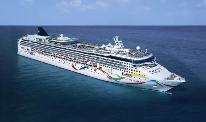
Founded in 1966, Miami-based Norwegian Cruise Line (NCL), part of global cruise company Norwegian Cruise Line Holdings (which also owns Oceania Cruises and Regent Seven Seas Cruises), is the third-largest cruise line in the world in terms of cruise passengers. NCL has become well-known for its colourful ships featuring a pop-icon style painted hull.

4100
Passengers
1724
Crew
2010
Launched
2020
Last refit
155873t
Tonnage
329m
Length
41m
Width
24kts
Speed
15
Decks
USD
Currency
Cruise Itinerary
Day 1
Port Canaveral, Florida, United States
Day 3
Puerto Plata, Dominican Republic
Day 4
Saint Thomas, U.S. Virgin Islands
Day 5
Road Town, Tortola, British Virgin Islands
Day 7
Great Stirrup Cay, Bahamas
Day 8
Port Canaveral, Florida, United States
Port Canaveral, Florida, United States image
Day 1
Port Canaveral, Florida, United States
Widely known for the Kennedy Space Center, Port Canaveral is located in the city of Cape Canaveral, home to beautiful beaches and Brevard Zoo.
Puerto Plata, Dominican Republic image
Day 3
Puerto Plata, Dominican Republic
San Felipe de Puerto Plata is the capital of the Puerto Plata province on the Dominican Republic’s Atlantic north coast. The city is best known for its beaches. Playa Dorada’s lengthy beachfront is backed by resorts and an 18-hole golf course. The city’s old colonial-era center is dominated by the 16th-century Fortaleza San Felipe, a Spanish fortress that now houses historical and military artifacts.
Saint Thomas, U.S. Virgin Islands image
Day 4
Saint Thomas, U.S. Virgin Islands
If you fly to the 32-square-mile (83-square-km) island of St. Thomas, you land at its western end; if you arrive by cruise ship, you come into one of the world's most beautiful harbors. Either way, one of your first sights is the town of Charlotte Amalie. From the harbor you see an idyllic-looking village that spreads into the lower hills. If you were expecting a quiet hamlet with its inhabitants hanging out under palm trees, you've missed that era by about 300 years. Although other islands in the USVI developed plantation economies, St. Thomas cultivated its harbor, and it became a thriving seaport soon after it was settled by the Danish in the 1600s. The success of the naturally perfect harbor was enhanced by the fact that the Danes—who ruled St. Thomas with only a couple of short interruptions from 1666 to 1917—avoided involvement in some 100 years' worth of European wars. Denmark was the only European country with colonies in the Caribbean to stay neutral during the War of the Spanish Succession in the early 1700s. Thus, products of the Dutch, English, and French islands—sugar, cotton, and indigo—were traded through Charlotte Amalie, along with the regular shipments of slaves. When the Spanish wars ended, trade fell off, but by the end of the 1700s Europe was at war again, Denmark again remained neutral, and St. Thomas continued to prosper. Even into the 1800s, while the economies of St. Croix and St. John foundered with the market for sugarcane, St. Thomas's economy remained vigorous. This prosperity led to the development of shipyards, a well-organized banking system, and a large merchant class. In 1845 Charlotte Amalie had 101 large importing houses owned by the English, French, Germans, Haitians, Spaniards, Americans, Sephardim, and Danes. Charlotte Amalie is still one of the world's most active cruise-ship ports. On almost any day at least one and sometimes as many as eight cruise ships are tied to the docks or anchored outside the harbor. Gently rocking in the shadows of these giant floating hotels are just about every other kind of vessel imaginable: sleek sailing catamarans that will take you on a sunset cruise complete with rum punch and a Jimmy Buffett soundtrack, private megayachts for billionaires, and barnacle-bottom sloops—with laundry draped over the lifelines—that are home to world-cruising gypsies. Huge container ships pull up in Sub Base, west of the harbor, bringing in everything from breakfast cereals to tires. Anchored right along the waterfront are down-island barges that ply the waters between the Greater Antilles and the Leeward Islands, transporting goods such as refrigerators, VCRs, and disposable diapers. The waterfront road through Charlotte Amalie was once part of the harbor. Before it was filled in to build the highway, the beach came right up to the back door of the warehouses that now line the thoroughfare. Two hundred years ago those warehouses were filled with indigo, tobacco, and cotton. Today the stone buildings house silk, crystal, and diamonds. Exotic fragrances are still traded, but by island beauty queens in air-conditioned perfume palaces instead of through open market stalls. The pirates of old used St. Thomas as a base from which to raid merchant ships of every nation, though they were particularly fond of the gold- and silver-laden treasure ships heading to Spain. Pirates are still around, but today's versions use St. Thomas as a drop-off for their contraband: illegal immigrants and drugs. To explore outside Charlotte Amalie, rent a car or hire a taxi. Your rental car should come with a good map; if not, pick up the pocket-size "St. Thomas–St. John Road Map" at a tourist information center. Roads are marked with route numbers, but they're confusing and seem to switch numbers suddenly. Roads are also identified by signs bearing the St. Thomas–St. John Hotel and Tourism Association's mascot, Tommy the Starfish. More than 100 of these color-coded signs line the island's main routes. Orange signs trace the route from the airport to Red Hook, green signs identify the road from town to Magens Bay, Tommy's face on a yellow background points from Mafolie to Crown Bay through the north side, red signs lead from Smith Bay to Four Corners via Skyline Drive, and blue signs mark the route from the cruise-ship dock at Havensight to Red Hook. These color-coded routes are not marked on most visitor maps, however. Allow yourself a day to explore, especially if you want to stop to take pictures or to enjoy a light bite or refreshing swim. Most gas stations are on the island's more populated eastern end, so fill up before heading to the north side. And remember to drive on the left!
Road Town, Tortola, British Virgin Islands image
Day 5
Road Town, Tortola, British Virgin Islands
Great Stirrup Cay, Bahamas image
Day 7
Great Stirrup Cay, Bahamas
Located 50 miles from Nassau, Great Stirrup Cay is a 250-acre island owned by Norwegian Cruise Line. A range of activities are on offer, including water sports, ping-pong, beach volleyball and a water slide. For lunch, the Jumbey Beach Grill offers barbecues on the beach. Afterwards, head to the Berried Treasure Bazaar to find a little something to bring back home.
Port Canaveral, Florida, United States image
Day 8
Port Canaveral, Florida, United States
Widely known for the Kennedy Space Center, Port Canaveral is located in the city of Cape Canaveral, home to beautiful beaches and Brevard Zoo.
Ship Details
Norwegian Cruise Line
Norwegian Epic

Explore the history of the Mediterranean, relax on the waters of the Transatlantic, or feel the balmy breezes of the Caribbean.. Whatever you choose to do, Norwegian Epic is sure to dazzle.

Find your perfect cruise!
Cabins
All Prices