21 nights onboard Regal Princess

21-Day Tropical Passage

Winners 2022 Best Ocean Cruise Line
Winners 2022 Favourite Luxury or Premium Cruise Line

Explore and revel in the latest offerings at sea

Enjoy sweeping views from one of more than 1,400 balconies on Regal Princess or stroll on the SeaWalk®, a glass-floor walkway extending 28 feet beyond the edge of the ship!

Leaving from: Southampton
Cruise ship: Regal Princess
Visiting: Southampton Le Havre Bilbao Vigo
Princess Cruises Logo
Princess Cruises

Credited with introducing millions of Americans to the concept of a modern cruise holiday, Princess Cruises is still innovating to this day.

Sporting a fleet of 17 ships with capacities ranging from 2,000 to 4,300 passengers, the line is best known for its Alaskan cruises, but travels to destinations the world over.

With an emphasis on destination leadership and local expertise, Princess is an excellent choice for the discerning traveller seeking to sail in comfort.
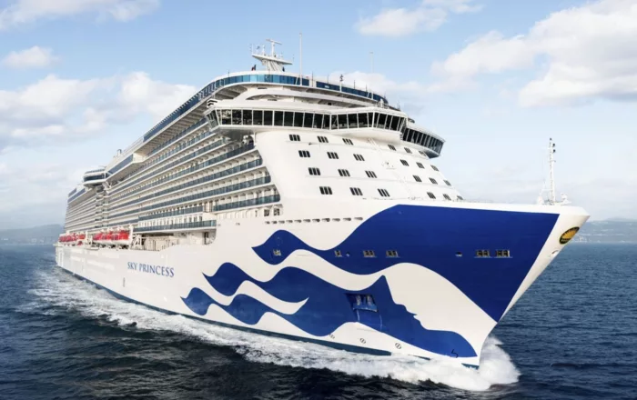
3560
Passengers
1346
Crew
2014
Launched
142000t
Tonnage
330m
Length
39m
Width
22kts
Speed
15
Decks
USD
Currency
Cruise Itinerary
Day 1
Southampton, England
Day 2
Le Havre, France
Day 4
Bilbao, Spain
Day 6
Vigo, Spain
Day 8
Funchal, Madeira, Portugal
Day 15
Saint John's, Antigua and Barbuda
Day 16
Saint Thomas, U.S. Virgin Islands
Day 19
Grand Cayman, Cayman Islands
Wheelchair Access Limited
Day 22
Galveston, Texas, United States
Southampton, England image
Day 1
Southampton, England

Lying near the head of Southampton Water, a peninsula between the estuaries of the Rivers Test and Itchen, Southampton is Britain’s largest cruise port. It has been one of England’s major ports since the Middle Ages, when it exported wool and hides from the hinterland and imported wine from Bordeaux. The city suffered heavy damage during World War Two and as a result the centre has been extensively rebuilt, but there are still some interesting medieval buildings including the Bargate, one of the finest city gatehouses in England.

Le Havre, France image
Day 2
Le Havre, France
Le Havre, founded by King Francis I of France in 1517, is located inUpper Normandy on the north bank of the mouth of the River Seine, which isconsidered the most frequented waterway in the world. Its port is ranked thesecond largest in France. The city was originally built on marshland andmudflats that were drained in the 1500’s. During WWII most of Le Havre wasdestroyed by Allied bombing raids. Post war rebuilding of the city followed thedevelopment plans of the well-known Belgian architect Auguste Perre. Thereconstruction was so unique that the entire city was listed as a UNESCO WorldHeritage Site in 2005. 
Bilbao, Spain image
Day 4
Bilbao, Spain
Time in Bilbao (Bilbo, in Euskera) may be recorded as BG or AG (Before Guggenheim or After Guggenheim). Never has a single monument of art and architecture so radically changed a city. Frank Gehry's stunning museum, Norman Foster's sleek subway system, the Santiago Calatrava glass footbridge and airport, the leafy César Pelli Abandoibarra park and commercial complex next to the Guggenheim, and the Philippe Starck AlhóndigaBilbao cultural center have contributed to an unprecedented cultural revolution in what was once the industry capital of the Basque Country.Greater Bilbao contains almost 1 million inhabitants, nearly half the total population of the Basque Country. Founded in 1300 by Vizcayan noble Diego López de Haro, Bilbao became an industrial center in the mid-19th century, largely because of the abundance of minerals in the surrounding hills. An affluent industrial class grew up here, as did the working class in suburbs that line the Margen Izquierda (Left Bank) of the Nervión estuary.Bilbao's new attractions get more press, but the city's old treasures still quietly line the banks of the rust-color Nervión River. The Casco Viejo (Old Quarter)—also known as Siete Calles (Seven Streets)—is a charming jumble of shops, bars, and restaurants on the river's Right Bank, near the Puente del Arenal bridge. This elegant proto-Bilbao nucleus was carefully restored after devastating floods in 1983. Throughout the Casco Viejo are ancient mansions emblazoned with family coats of arms, wooden doors, and fine ironwork balconies. The most interesting square is the 64-arch Plaza Nueva, where an outdoor market is pitched every Sunday morning.Walking the banks of the Nervión is a satisfying jaunt. After all, this was how—while out on a morning jog—Guggenheim director Thomas Krens first discovered the perfect spot for his project, nearly opposite the right bank's Deusto University. From the Palacio de Euskalduna upstream to the colossal Mercado de la Ribera, parks and green zones line the river. César Pelli's Abandoibarra project fills in the half mile between the Guggenheim and the Euskalduna bridge with a series of parks, the Deusto University library, the Meliá Bilbao Hotel, and a major shopping center.On the left bank, the wide, late-19th-century boulevards of the Ensanche neighborhood, such as Gran Vía (the main shopping artery) and Alameda de Mazarredo, are the city's more formal face. Bilbao's cultural institutions include, along with the Guggenheim, a major museum of fine arts (the Museo de Bellas Artes) and an opera society (Asociación Bilbaína de Amigos de la Ópera, or ABAO) with 7,000 members from Spain and southern France. In addition, epicureans have long ranked Bilbao's culinary offerings among the best in Spain. Don't miss a chance to ride the trolley line, the Euskotram, for a trip along the river from Atxuri Station to Basurto's San Mamés soccer stadium, reverently dubbed "la Catedral del Fútbol" (the Cathedral of Football).
Vigo, Spain image
Day 6
Vigo, Spain
Dating from Roman times, the Galician city of Vigo has a fine natural harbour and is renowned as the biggest fishing port in the world. It is also full of history - it was in this fjord-like quay that the English and Dutch defeated the French and Spanish fleets in 1702. Today, the attractive marinas stand in contrast to the industrialised areas of the city, while further exploration will reveal the characteristic 17th-century architecture and attractive countryside beyond. The charming Old Town is a delight, with its labyrinth of winding narrow streets and shaded squares. Nearby is the Cathedral city of Tui, and further to the north is the pilgrimage centre of Santiago de Compostela, which can be reached by car in approximately 1¼ hours.
Funchal, Madeira, Portugal image
Day 8
Funchal, Madeira, Portugal
Formed by a volcanic eruption, Madeira lies in the Gulf Stream, about 500 miles due west of Casablanca. Discovered by Portuguese explorer João Gonçalves Zarco in 1419, this beautiful island became part of Portugal’s vast empire and was named for the dense forest which cloaked it - 'Madeira' means 'wood' in Portuguese. Sugar plantations first brought wealth here, and when King Charles II of England granted an exclusive franchise to sell wine to England and its colonies, many British emigrants were drawn to the capital, Funchal. Today’s travellers come to Madeira for the varied and luxuriant scenery, from mountain slopes covered with vines to picturesque villages and a profusion of wild flowers. The natural beauty of the island has earned it many pseudonyms such as ‘The Floating Garden of the Atlantic’, 'The Island of Eternal Springtime' and ‘God’s Botanical Gardens’ and our selection of excursions aim to show you why.
Saint John's, Antigua and Barbuda image
Day 15
Saint John's, Antigua and Barbuda
With its superb beaches, historical attractions and beautiful coral reefs, Antigua provides a host of diversions. It is said that the island contains 365 beaches, one for every day of the year. Antigua maintains its traditional West Indian character, with gingerbread-house style architecture, calypso music and carnival festivities. St John’s has been the administrative capital since the island’s colonisation in 1632, and has been the seat of government since it gained independence in 1981. From the port you can explore the colourful Redcliffe district, with its restored wooden houses, and Heritage Quay with its shopping mall and craft shops. The city has some fine examples of Colonial architecture, including the twin-towered cathedral, built in 1845 and considered one of the finest church buildings in the Caribbean. All coaches in Antigua are operated by smaller vehicles, and commentary will be given by a driver/guide.
Saint Thomas, U.S. Virgin Islands image
Day 16
Saint Thomas, U.S. Virgin Islands
If you fly to the 32-square-mile (83-square-km) island of St. Thomas, you land at its western end; if you arrive by cruise ship, you come into one of the world's most beautiful harbors. Either way, one of your first sights is the town of Charlotte Amalie. From the harbor you see an idyllic-looking village that spreads into the lower hills. If you were expecting a quiet hamlet with its inhabitants hanging out under palm trees, you've missed that era by about 300 years. Although other islands in the USVI developed plantation economies, St. Thomas cultivated its harbor, and it became a thriving seaport soon after it was settled by the Danish in the 1600s. The success of the naturally perfect harbor was enhanced by the fact that the Danes—who ruled St. Thomas with only a couple of short interruptions from 1666 to 1917—avoided involvement in some 100 years' worth of European wars. Denmark was the only European country with colonies in the Caribbean to stay neutral during the War of the Spanish Succession in the early 1700s. Thus, products of the Dutch, English, and French islands—sugar, cotton, and indigo—were traded through Charlotte Amalie, along with the regular shipments of slaves. When the Spanish wars ended, trade fell off, but by the end of the 1700s Europe was at war again, Denmark again remained neutral, and St. Thomas continued to prosper. Even into the 1800s, while the economies of St. Croix and St. John foundered with the market for sugarcane, St. Thomas's economy remained vigorous. This prosperity led to the development of shipyards, a well-organized banking system, and a large merchant class. In 1845 Charlotte Amalie had 101 large importing houses owned by the English, French, Germans, Haitians, Spaniards, Americans, Sephardim, and Danes. Charlotte Amalie is still one of the world's most active cruise-ship ports. On almost any day at least one and sometimes as many as eight cruise ships are tied to the docks or anchored outside the harbor. Gently rocking in the shadows of these giant floating hotels are just about every other kind of vessel imaginable: sleek sailing catamarans that will take you on a sunset cruise complete with rum punch and a Jimmy Buffett soundtrack, private megayachts for billionaires, and barnacle-bottom sloops—with laundry draped over the lifelines—that are home to world-cruising gypsies. Huge container ships pull up in Sub Base, west of the harbor, bringing in everything from breakfast cereals to tires. Anchored right along the waterfront are down-island barges that ply the waters between the Greater Antilles and the Leeward Islands, transporting goods such as refrigerators, VCRs, and disposable diapers. The waterfront road through Charlotte Amalie was once part of the harbor. Before it was filled in to build the highway, the beach came right up to the back door of the warehouses that now line the thoroughfare. Two hundred years ago those warehouses were filled with indigo, tobacco, and cotton. Today the stone buildings house silk, crystal, and diamonds. Exotic fragrances are still traded, but by island beauty queens in air-conditioned perfume palaces instead of through open market stalls. The pirates of old used St. Thomas as a base from which to raid merchant ships of every nation, though they were particularly fond of the gold- and silver-laden treasure ships heading to Spain. Pirates are still around, but today's versions use St. Thomas as a drop-off for their contraband: illegal immigrants and drugs. To explore outside Charlotte Amalie, rent a car or hire a taxi. Your rental car should come with a good map; if not, pick up the pocket-size "St. Thomas–St. John Road Map" at a tourist information center. Roads are marked with route numbers, but they're confusing and seem to switch numbers suddenly. Roads are also identified by signs bearing the St. Thomas–St. John Hotel and Tourism Association's mascot, Tommy the Starfish. More than 100 of these color-coded signs line the island's main routes. Orange signs trace the route from the airport to Red Hook, green signs identify the road from town to Magens Bay, Tommy's face on a yellow background points from Mafolie to Crown Bay through the north side, red signs lead from Smith Bay to Four Corners via Skyline Drive, and blue signs mark the route from the cruise-ship dock at Havensight to Red Hook. These color-coded routes are not marked on most visitor maps, however. Allow yourself a day to explore, especially if you want to stop to take pictures or to enjoy a light bite or refreshing swim. Most gas stations are on the island's more populated eastern end, so fill up before heading to the north side. And remember to drive on the left!
Grand Cayman, Cayman Islands image
Day 19
Grand Cayman, Cayman Islands
Wheelchair Access Limited
Galveston, Texas, United States image
Day 22
Galveston, Texas, United States
Located 50 miles from the better known Houston, the city of Galveston is very different, both in terms of atmosphere and attractions. Her Moody Gardens are probably her biggest attraction, offering families the chance to discover and learn about fauna and flora together whilst having fun. The refurbished Galveston Island Historic Pier is also a great place to spend some time with the family.
Ship Details
Princess Cruises
Regal Princess

Explore and revel in the latest offerings at sea

Enjoy sweeping views from one of more than 1,400 balconies on Regal Princess or stroll on the SeaWalk®, a glass-floor walkway extending 28 feet beyond the edge of the ship!

Find your perfect cruise!
Cabins
All Prices