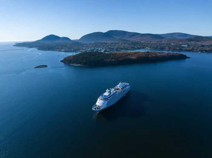
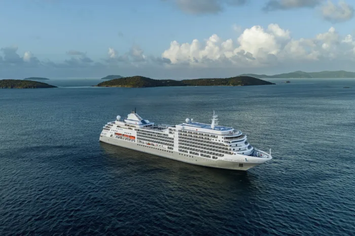
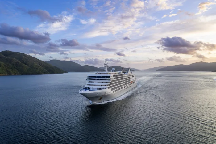
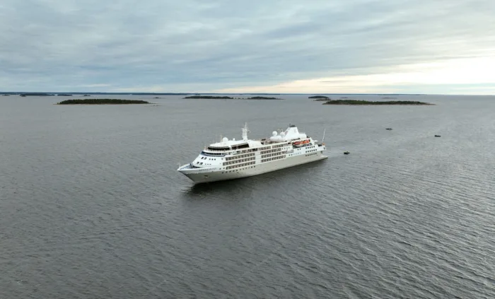
13 nights onboard Silver Shadow

Seward (Anchorage to Vancouver

Award-winning Silver Shadow has all the hallmarks of extreme luxury at sea. With one of the highest space-to-guest ratios at sea, Silver Shadow is a firm favourite in the Silversea fleet.

Leaving from: Seward, Alaska
Cruise ship: Silver Shadow
Visiting: Seward, Alaska Icy Strait Point Haines, Alaska Sitka, Alaska
Silversea Cruises Logo
Silversea Cruises

Wellness should be about balanced indulgence, not self-sacrifice - that's the philosophy behind Silversea's new programme called Otium, named after the Roman leisure time dedicated to bathing, talking, singing, drinking, eating and relaxing. The easygoing regime includes a 24-hour room-service menu of comfort food, as well as new spa treatments, relaxing baths and hot chocolate served on your balcony.

388
Passengers
302
Crew
2000
Launched
2017
Last refit
28258t
Tonnage
186m
Length
24.9m
Width
18kts
Speed
7
Decks
USD
Currency
Cruise Itinerary
Day 1
Seward, Alaska, Alaska
Day 2
River travel
Day 3
Icy Strait Point, United States
Day 4
Haines, Alaska, Alaska
Day 5
Sitka, Alaska, Alaska
Day 6
Juneau, Alaska, Alaska
Day 7
Tracy Arm, Alaska, Alaska
Day 8
Wrangell, Alaska, Alaska
Day 9
Ketchikan, Alaska, Alaska
Day 10
Prince Rupert, British Columbia, Canada
Day 11
River travel
Day 12
Victoria, British Columbia, Canada
Days 13 - 14
Vancouver, British Columbia, Canada
Seward, Alaska, Alaska image
Day 1
Seward, Alaska, Alaska
It is hard to believe that a place as beautiful as Seward exists. Surrounded on all sides by Kenai Fjords National Park, Chugach National Forest, and Resurrection Bay, Seward offers all the quaint realities of a small railroad town with the bonus of jaw-dropping scenery. This little town of about 2,750 citizens was founded in 1903, when survey crews arrived at the ice-free port and began planning a railroad to the Interior. Since its inception, Seward has relied heavily on tourism and commercial fishing. It is also the launching point for excursions into Kenai Fjords National Park, where it is quite common to see marine life and calving glaciers.
River travel image
Day 2
River travel
Icy Strait Point, United States image
Day 3
Icy Strait Point, United States
Since Icy Strait Point opened in 2004, Hoonah has attracted more visitors, particularly those who arrive by cruise ship. The port is centered around the restored salmon cannery, which now houses a museum, local arts and crafts shops, restaurants, and a mid-1930s cannery line display. Outside is the world’s largest and highest zip line at 5,330 feet long, featuring a 1,300-foot vertical drop—a thrilling ride with fantastic views of the surrounding mountains and ocean. If you're looking for more relaxing mountaintop views, book a gondola ride that will whisk you up into the mountains for some leisurely hiking and stellar sightseeing. Icy Strait Point houses several restaurants where visitors can dine on freshly caught seafood while taking in the waterfront views. A range of excursions are available at Icy Strait Point catering primarily to cruise ship passengers, from Alaska Native dance performances to bear viewing and whale watching.
Haines, Alaska, Alaska image
Day 4
Haines, Alaska, Alaska
Unlike most cities of Southeast Alaska, Haines can be reached by road. With a population of 2,200, Haines lies in the upper northern reaches of the Inside Passage and is an important access point to the Yukon Territory and Interior Alaska. While cruising into Haines, see the Lynn Canal, the longest and deepest fjord in North America. Once in town, mountains seem to surround you on all sides while the jagged cathedral peaks of the Chilkat Mountains loom over Fort Seward. Haines has two distinct personalities. On the north side of the Haines Highway is the section of Haines that developed around the Presbyterian mission. After its missionary beginnings, it served as the trailhead for the Jack Dalton Trail into the Yukon during the 1897 gold rush to the Klondike. South of the highway, the town resembles a military post, which is exactly what it was for nearly half a century. In 1903 the U.S. Army established Fort William Henry Seward at Portage Cove just south of town. The post (renamed Chilkoot Barracks in 1922) was the only military base in the territory until World War II. In 1939, the army built the Alaska Highway and the Haines Highway to connect Alaska with the other states. Today, the community of Haines is recognized for the Native American dance and culture center at Fort Seward as well as for its superb fishing, camping and outdoor recreation.
Sitka, Alaska, Alaska image
Day 5
Sitka, Alaska, Alaska
It's hard not to like Sitka, with its eclectic blend of Alaska Native, Russian, and American history and its dramatic and beautiful open-ocean setting. This is one of the best Inside Passage towns to explore on foot, with St. Michael's Cathedral, Sheldon Jackson Museum, Castle Hill, Sitka National Historical Park, and the Alaska Raptor Center topping the must-see list.Sitka was home to the Kiksádi clan of the Tlingit people for centuries prior to the 18th-century arrival of the Russians under the direction of territorial governor Alexander Baranof, who believed the region was ideal for the fur trade. The governor also coveted the Sitka site for its beauty, mild climate, and economic potential; in the island's massive timber forests he saw raw materials for shipbuilding. Its location offered trading routes as far west as Asia and as far south as California and Hawaii. In 1799 Baranof built St. Michael Archangel—a wooden fort and trading post 6 miles north of the present town.Strong disagreements arose shortly after the settlement. The Tlingits attacked the settlers and burned their buildings in 1802. Baranof, however, was away in Kodiak at the time. He returned in 1804 with a formidable force—including shipboard cannons—and attacked the Tlingits at their fort near Indian River, site of the present-day 105-acre Sitka National Historical Park, forcing many of them north to Chichagof Island.By 1821 the Tlingits had reached an accord with the Russians, who were happy to benefit from the tribe's hunting skills. Under Baranof and succeeding managers, the Russian-American Company and the town prospered, becoming known as the Paris of the Pacific. The community built a major shipbuilding and repair facility, sawmills, and forges, and even initiated an ice industry, shipping blocks of ice from nearby Swan Lake to the booming San Francisco market. The settlement that was the site of the 1802 conflict is now called Old Sitka. It is a state park and listed as a National Historic Landmark.The town declined after its 1867 transfer from Russia to the United States, but it became prosperous again during World War II, when it served as a base for the U.S. effort to drive the Japanese from the Aleutian Islands. Today its most important industries are fishing, government, and tourism.
Juneau, Alaska, Alaska image
Day 6
Juneau, Alaska, Alaska
Juneau, Alaska's capital and third-largest city, is on the North American mainland but can't be reached by road. Bounded by steep mountains and water, the city’s geographic isolation and compact size make it much more akin to an island community such as Sitka than to other Alaskan urban centers, such as Fairbanks or Anchorage. Juneau is full of contrasts. Its dramatic hillside location and historic downtown buildings provide a frontier feeling, but the city's cosmopolitan nature comes through in fine museums, noteworthy restaurants, and a literate and outdoorsy populace. The finest of the museums, the Alaska State Museum, is scheduled to reopen in May 2016 on its old site as the expanded Alaska State Library, Archives, and Museum (SLAM) following several years of planning and exhibit research. Another new facility, the Walter Soboleff Center, offers visitors a chance to learn about the indigenous cultures of Southeast Alaska–-Tlingit, Haida, and Tsimshian. Other highlights include the Mt. Roberts Tramway, plenty of densely forested wilderness areas, quiet bays for sea kayaking, and even a famous drive-up glacier, Mendenhall Glacier. For goings-on, pick up the Juneau Empire (www.juneauempire.com), which keeps tabs on state politics, business, sports, and local news.
Tracy Arm, Alaska, Alaska image
Day 7
Tracy Arm, Alaska, Alaska
As part of the Tracy Arm-Fords Terror Wilderness, Tracy Arm is within the Tongass National Forest. Tracy Arm is one of Alaska’s classic fjords. At the end of the narrow and almost 50 km long fjord, passing breathtaking mountains, steep cliffs and spectacular waterfalls, one can see the twin Sawyer Glaciers, South Sawyer and North Sawyer, active tidewater glaciers. Wildlife of the area includes whales, harbor seals, eagles, kittiwakes, Arctic Terns and Pigeon Guillemots.
Wrangell, Alaska, Alaska image
Day 8
Wrangell, Alaska, Alaska
A small, unassuming timber and fishing community, Wrangel sits on the northern tip of Wrangel Island, near the mouth of the fast-flowing Stikine River—North America's largest undammed river. The Stikine plays a large role in the life of many Wrangel residents, including those who grew up homesteading on the islands that pepper the area. Trips on the river with local guides are highly recommended as they provide, basically, an insider's guide to the Stikine and a very Alaskan way of life. Like much of Southeast, Wrangel has suffered in recent years from a declining resource-based economy. But locals are working to build tourism in the town. Bearfest, which started in 2010, celebrates Wrangel's proximity to Anan Creek, where you can get a close-up view of both brown and black bears. Wrangel has flown three different national flags in its time. Russia established Redoubt St. Dionysius here in 1834. Five years later Great Britain's Hudson's Bay Company leased the southern Alaska coastline, renaming the settlement Ft. Stikine. It was rechristened Wrangel when the Americans took over in 1867; the name came from Baron Ferdinand Petrovich von Wrangel, governor of the Russian-American Company. The rough-around-the-edges town is off the track of the larger cruise ships, so it does not get the same seasonal traffic that Ketchikan and Juneau do. Hence, it is nearly devoid of the souvenir shops that dominate so many other nearby downtown areas. But the gift shops and art galleries that are here do sell locally created work, and the town is very welcoming to visitors; independent travelers would do well to add a stop in Wrangel during their Southeast wanderings.
Ketchikan, Alaska, Alaska image
Day 9
Ketchikan, Alaska, Alaska
Ketchikan is famous for its colorful totem poles, rainy skies, steep–as–San Francisco streets, and lush island setting. Some 13,500 people call the town home, and, in the summer, cruise ships crowd the shoreline, floatplanes depart noisily for Misty Fiords National Monument, and salmon-laden commercial fishing boats motor through Tongass Narrows. In the last decade Ketchikan's rowdy, blue-collar heritage of logging and fishing has been softened by the loss of many timber-industry jobs and the dramatic rise of cruise-ship tourism. With some effort, though, visitors can still glimpse the rugged frontier spirit that once permeated this hardscrabble cannery town. Art lovers should make a beeline for Ketchikan: the arts community here is very active. Travelers in search of the perfect piece of Alaska art will find an incredible range of pieces to choose from.The town is at the foot of 3,000-foot Deer Mountain, near the southeastern corner of Revillagigedo (locals shorten it to Revilla) Island. Prior to the arrival of white miners and fishermen in 1885, the Tlingit used the site at the mouth of Ketchikan Creek as a summer fish camp. Gold discoveries just before the turn of the 20th century brought more immigrants, and valuable timber and commercial fishing resources spurred new industries. By the 1930s the town bragged that it was the "salmon-canning capital of the world." You will still find some of Southeast's best salmon fishing around here. Ketchikan is the first bite of Alaska that many travelers taste. Despite its imposing backdrop, hillside homes, and many staircases, the town is relatively easy to walk through. Favorite downtown stops include the Spruce Mill Development shops and Creek Street. A bit farther away you'll find the Totem Heritage Center. Out of town (but included on most bus tours) are two longtime favorites: Totem Bight State Historical Park to the north and Saxman Totem Park to the south.
Prince Rupert, British Columbia, Canada image
Day 10
Prince Rupert, British Columbia, Canada
Just 40 mi (66 km) south of the Alaskan border, Prince Rupert is the largest community on British Columbia's north coast. Set on Kaien Island at the mouth of the Skeena River and surrounded by deep green fjords and coastal rain forest, Prince Rupert is rich in the culture of the Tsimshian, people who have been in the area for thousands of years. As the western terminus of Canada's second transcontinental railroad and blessed with a deep natural harbor, Prince Rupert was, at the time of its incorporation in 1910, poised to rival Vancouver as a center for trans-Pacific trade. This didn't happen, partly because the main visionary behind the scheme, Grand Trunk Pacific Railroad president Charles Hays, went down with the Titanic on his way back from a financing trip to England. Prince Rupert turned instead to fishing and forestry. A port of call for both BC and Alaska ferries, but relatively new to cruise ships, this community of 15,000 retains a laid-back, small-town air.
River travel image
Day 11
River travel
Victoria, British Columbia, Canada image
Day 12
Victoria, British Columbia, Canada
Victoria, the capital of a province whose license plates brazenly label it "The Best Place on Earth," is a walkable, livable seaside city of fragrant gardens, waterfront paths, engaging museums, and beautifully restored 19th-century architecture. In summer, the Inner Harbour—Victoria's social and cultural center—buzzes with visiting yachts, horse-and-carriage rides, street entertainers, and excursion boats heading out to visit pods of friendly local whales. Yes, it might be a bit touristy, but Victoria's good looks, gracious pace, and manageable size are instantly beguiling, especially if you stand back to admire the mountains and ocean beyond. At the southern tip of Vancouver Island, Victoria dips slightly below the 49th parallel. That puts it farther south than most of Canada, giving it the mildest climate in the country, with virtually no snow and less than half the rain of Vancouver. The city's geography, or at least its place names, can cause confusion. Just to clarify: the city of Victoria is on Vancouver Island (not Victoria Island). The city of Vancouver is on the British Columbia mainland, not on Vancouver Island. At any rate, that upstart city of Vancouver didn't even exist in 1843 when Victoria, then called Fort Victoria, was founded as the westernmost trading post of the British-owned Hudson's Bay Company. Victoria was the first European settlement on Vancouver Island, and in 1868 it became the capital of British Columbia. The British weren't here alone, of course. The local First Nations people—the Songhees, the Saanich, and the Sooke—had already lived in the areas for thousands of years before anyone else arrived. Their art and culture are visible throughout southern Vancouver Island. You can see this in private and public galleries, in the totems at Thunderbird Park, in the striking collections at the Royal British Columbia Museum, and at the Quw'utsun'Cultural and Conference Centre in nearby Duncan. Spanish explorers were the first foreigners to explore the area, although they left little more than place names (Galiano Island and Cordova Bay, for example). The thousands of Chinese immigrants drawn by the gold rushes of the late 19th century had a much greater impact, founding Canada's oldest Chinatown and adding an Asian influence that's still quite pronounced in Victoria's multicultural mix. Despite its role as the provincial capital, Victoria was largely eclipsed, economically, by Vancouver throughout the 20th century. This, as it turns out, was all to the good, helping to preserve Victoria's historic downtown and keeping the city largely free of skyscrapers and highways. For much of the 20th century, Victoria was marketed to tourists as "The Most British City in Canada," and it still has more than its share of Anglo-themed pubs, tea shops, and double-decker buses. These days, however, Victorians prefer to celebrate their combined indigenous, Asian, and European heritage, and the city's stunning wilderness backdrop. Locals do often venture out for afternoon tea, but they're just as likely to nosh on dim sum or tapas. Decades-old shops sell imported linens and tweeds, but newer upstarts offer local designs in hemp and organic cotton. And let's not forget that fabric prevalent among locals: Gore-Tex. The outdoors is ever present here. You can hike, bike, kayak, sail, or whale-watch straight from the city center, and forests, beaches, offshore islands, and wilderness parklands lie just minutes away. A little farther afield, there's surfing near Sooke, wine touring in the Cowichan Valley, and kayaking among the Gulf Islands.
Vancouver, British Columbia, Canada image
Days 13 - 14
Vancouver, British Columbia, Canada
Vancouver is a delicious juxtaposition of urban sophistication and on-your-doorstep wilderness adventure. The mountains and seascape make the city an outdoor playground for hiking, skiing, kayaking, cycling, and sailing—and so much more—while the cuisine and arts scenes are equally diverse, reflecting the makeup of Vancouver's ethnic (predominantly Asian) mosaic. Vancouver is consistently ranked as one of the world's most livable cities, and it's easy for visitors to see why. It's beautiful, it's outdoorsy, and there's a laidback West Coast vibe. On the one hand, there's easy access to a variety of outdoor activities, a fabulous variety of beaches, and amazing parks. At the same time, the city has a multicultural vitality and cosmopolitan flair. The attraction is as much in the range of food choices—the fresh seafood and local produce are some of North America's best—as it is in the museums, shopping, and nightlife.Vancouver's landscaping also adds to the city's walking appeal. In spring, flowerbeds spill over with tulips and daffodils while sea breezes scatter scented cherry blossoms throughout Downtown; in summer office workers take to the beaches, parks, and urban courtyards for picnic lunches and laptop meetings. More than 8 million visitors each year come to Vancouver, Canada's third-largest metropolitan area. Because of its peninsula location, traffic flow is a contentious issue. Thankfully, Vancouver is wonderfully walkable, especially in the downtown core. The North Shore is a scoot across the harbor, and the rapid-transit system to Richmond and the airport means that staying in the more affordable ’burbs doesn't have to be synonymous with sacrificing convenience. The mild climate, exquisite natural scenery, and relaxed outdoor lifestyle keep attracting residents, and the number of visitors is increasing for the same reasons. People often get their first glimpse of Vancouver when catching an Alaskan cruise, and many return at some point to spend more time here.
Ship Details
Silversea Cruises
Silver Shadow

Award-winning Silver Shadow has all the hallmarks of extreme luxury at sea. With one of the highest space-to-guest ratios at sea, Silver Shadow is a firm favourite in the Silversea fleet.

Find your perfect cruise!
All Prices